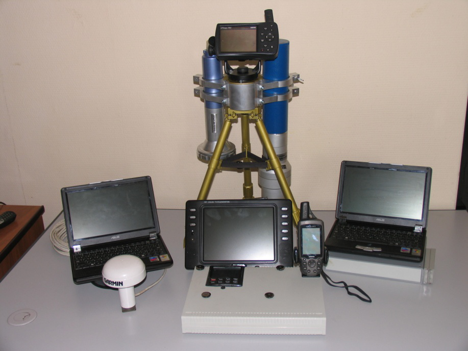
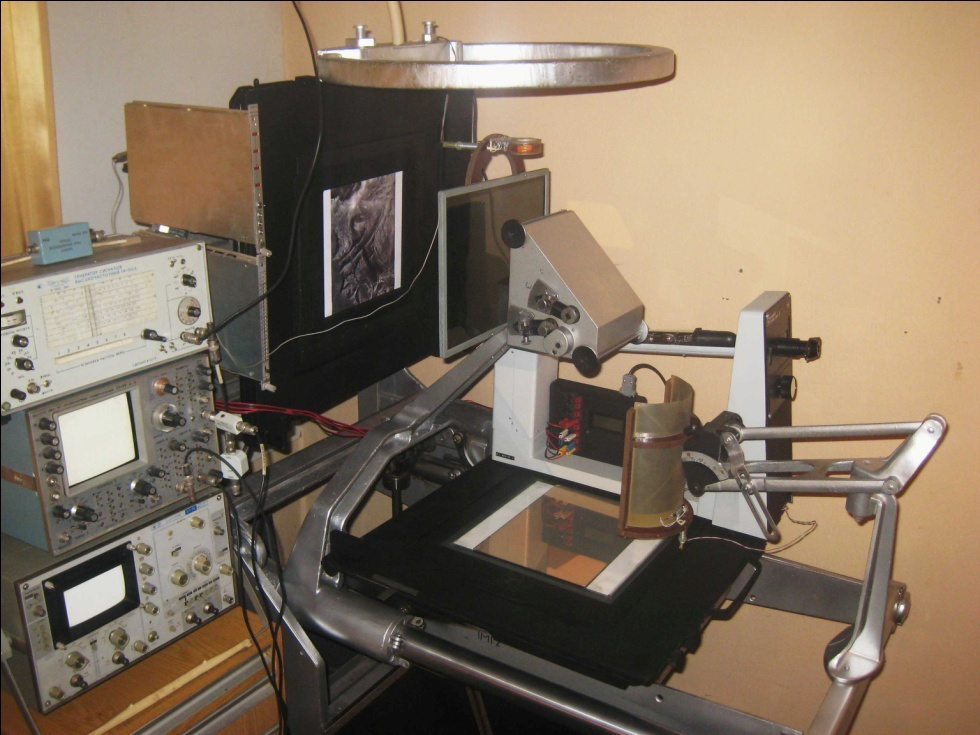
Our proprietary methods and know-how are tools for performing "direct mineral exploration."
- AGRS — Aerospace Geophysics Remote Sensing
- X-Vision — predictive exploration data processing technology
- FSSAT — Frequency-Spatial Spectral Analysis Technology
AGRS — Fixed-Wing Configuration
KINPRO's AGRS is the overarching technical framework coordinating multi-sensor airborne remote sensing. It collects gravity and magnetic measurements that form the basis for X-Vision data processing. Stage 1 (Reconnaissance) relies on satellite processing (FSSAT) to screen barren ground, while Stage 2 (Appraisal) utilizes high-resolution data from AGRS flight surveys to generate depth-calibrated subsurface maps.
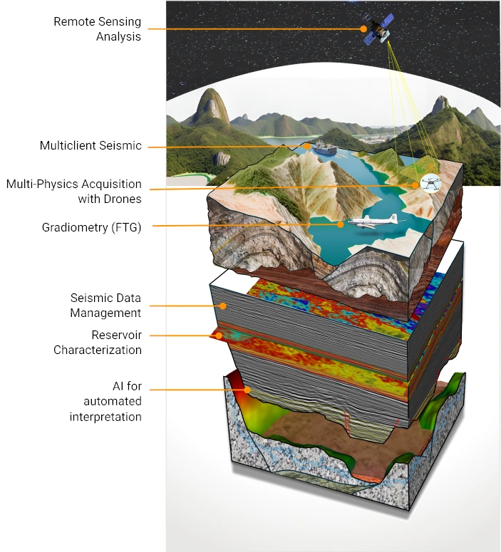
Cutaway block diagram of the AGRS remote geological-exploration workflow
X-Vision — A Breakthrough Exploration Technology
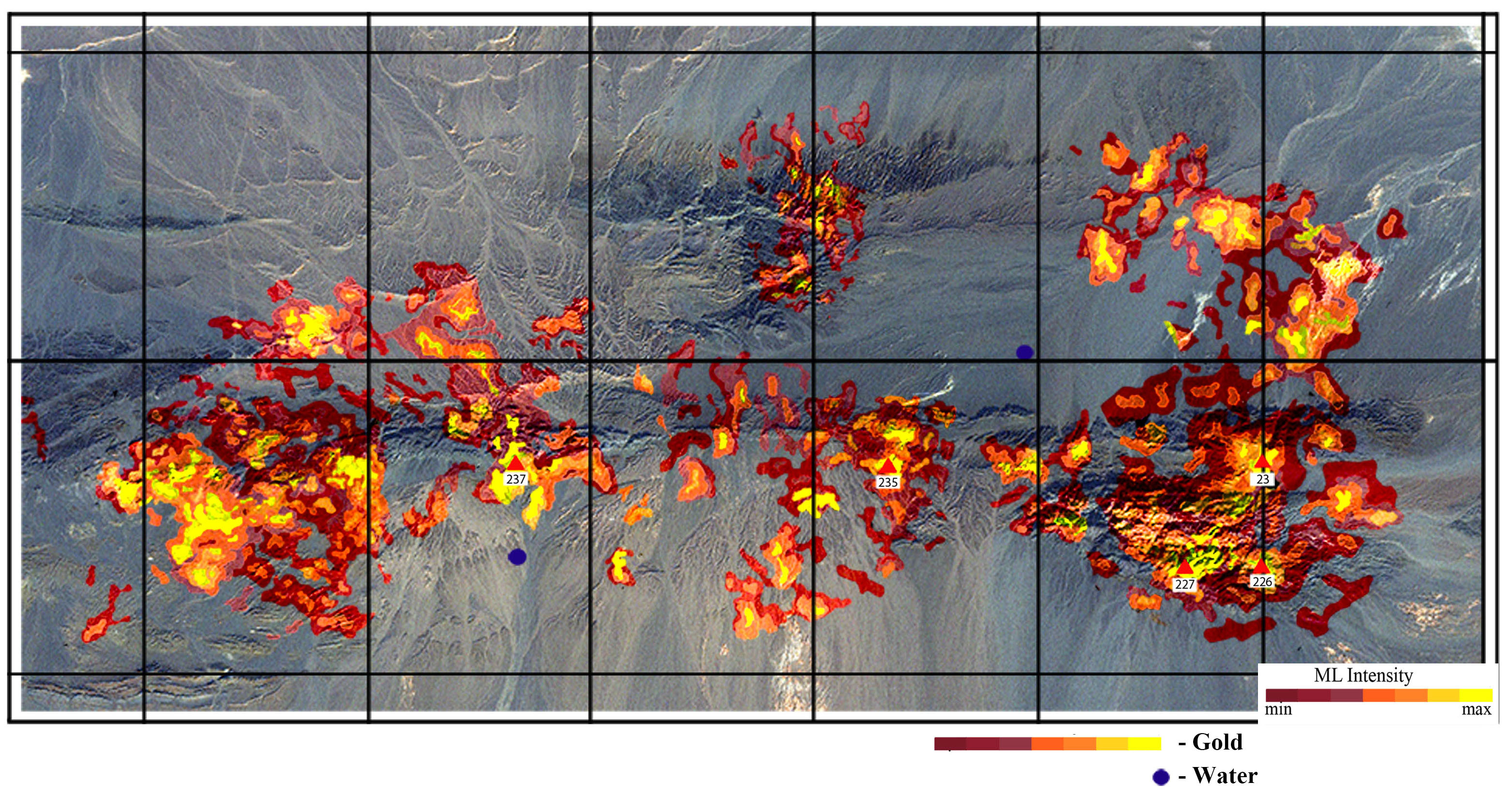
Primary localization of gold (Au) occurrences and fresh groundwater in Mongolia using X-Vision Technology
X-Vision has proven its effectiveness for mineral exploration during more than 25 years of application. This predictive-exploration technology enables rapid remote identification of targets associated with principal deposit types—including gas, oil, ore, kimberlitic/non-kimberlitic diamond occurrences, and groundwater. Historically, 90–95% of selected X-Vision targets have subsequently been confirmed by follow-up exploration under KINPRO’s internal validation criteria.
Its principal advantages over conventional technologies include shorter timelines, lower cost, depth penetration (up to 10 km), applicability in any rock type, a high probability of detection, and the ability to work in difficult-to-access regions. The technology is environmentally friendly and represents a highly distinctive approach globally.
X-Vision enables exploration:
- Over vast territories, in a very short time.
- With uniform assessment of the entire study area, regardless of geological complexity.
- In difficult-to-access territories and areas with thick overburden.
- Offshore, with reduced—or zero—environmental impact.
- Remotely, discreetly, and rapidly—ahead of a decision to participate in a tender.
- On areas with known deposits and existing infrastructure (re-surveying to identify missed deposits).
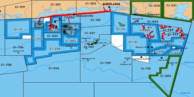
Satellite X-Vision survey. Offshore license-block map showing hydrocarbon micro-seepage points (red/white) localized in GPS coordinates.
FSSAT for Final Assessment
This advanced analytical framework demonstrates its value in subsurface exploration. We use it to verify previously obtained results and to benchmark effectiveness.
Based on proprietary multi-factor spatial and frequency spectral analysis of satellite data, this technology provides the means to search for various mineral types and to study the deep structure of geological sections in regions around the world. Research conducted across different countries and regions has indicated that this highly mobile technology can significantly accelerate and optimize the search for ore minerals, hydrocarbons, and commercial groundwater resources.
Original equipment for FSSAT data processing