
Exploration Applications
Hydrocarbons
Oil-and-gas companies are increasingly exploring in areas that are difficult in terms of geology, climate, and infrastructure alike. The high mobility and relatively low cost of aerospace geophysical surveys substantially reduce both the time and the expense of exploration for hydrocarbon discovery and production, while minimizing environmental impact.
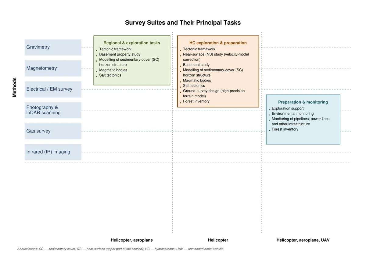
Given the expanded choice of airborne platforms and the modernization of instrumentation, the range of aerogeophysical services for hydrocarbon exploration can be grouped into three principal blocks:
- Block 1 (the historically traditional block) includes satellite gravimetry and magnetometry, and multispectral and hyperspectral imaging. It addresses regional and exploration objectives that are most relevant when a producing company is seeking access to a license area.
- Block 2: In addition to airborne gravity and magnetic surveying, it includes airborne EM and passive EM sensing as well as LiDAR scanning. Both helicopters and fixed-wing aircraft serve as airborne platforms here.
- Block 3: Based on previous data, it supports the preparation and monitoring of exploration for the oil-and-gas industry. Its method set allows ultralight aircraft and UAVs to serve as airborne platforms.
Mineral Exploration
The defining features of aerospace geophysical surveys—high productivity, integration, low cost, and information density—make them ideal for use as reconnaissance work, so that their interpreted results can guide the search process during the main exploration phase.
A key advantage of aerospace geophysical technology is the value and effectiveness of method integration. The current method set for solid-mineral exploration includes:
- Aerospace magnetic surveying (always).
- Time-domain or frequency-domain airborne electromagnetics (in most cases).
- Airborne gamma-ray spectrometry (in most cases).
- Aerospace gravity surveying (in selected cases).
- LiDAR and Passive EM sensing (as needed).
Following full in-house processing, the client receives a digital archive of survey-line data, matrices of the physical fields and their transforms, a set of contour maps, and a report describing survey and processing methods and equipment, together with data confirming the quality of the work performed.
Integrated data interpretation then follows. In the first analytical stage, a general interpretation addresses broad geological objectives. The exploration focus is developed primarily in the next interpretation stage, drawing on the full body of available a priori geological and geophysical information.
The resulting deliverables are:
- A scheme of geological-geophysical interpretation results with predictive elements, highlighting the most contrasting features of the geological structure, the criteria and indicators of mineralization, and prospective first- and second-priority areas.
- A report describing the interpretation methodology and results, together with recommendations on the direction and sequence of further exploration in the prospective ore-bearing areas.