
Exploration Services
AGRS — Fixed-Wing Gravity & Magnetics
All airborne geophysical survey programs are planned and executed mainly on an individual basis against a client-supplied Statement of Work (SOW).
Primary Objectives & Applications
Mineral & Hydrocarbon Exploration
Airborne geophysical methods are the primary tool for detecting ore deposits — including base metals, precious metals, and diamonds — as well as hydrocarbon accumulations and subsurface freshwater aquifer lenses with commercially viable characteristics. The methods are equally applied to the mapping of potentially ore-bearing structures.
Geological Mapping
Surveys generate detailed geological-structural plans and subsurface models, characterizing deep crustal architecture and delineating fault zones, anticlines, synclines, and other tectonic elements.
Environmental Monitoring
Airborne geophysical methods identify contamination zones, assess radiological conditions, and support ecosystem monitoring programs.
Archaeological Prospecting
Airborne geophysical surveys detect subsurface archaeological features without surface disturbance.
Detection of Subsurface Man-Made Objects
The method is effective for locating underground structures, voids, legacy mine workings, and other anthropogenic subsurface features.
Engineering & Hydrogeological Site Investigation
Surveys characterize soil properties, groundwater levels, and potential geotechnical hazards relevant to construction planning.
Survey Modalities
Airborne geophysical methods and technologies are applied both at the evaluation stages of prospective oil and gas acreage and during the planning and monitoring of active exploration programs (GRR), as well as environmental surveillance and pipeline monitoring.
Survey types include: gravimetry, magnetometry, airborne electromagnetics, LiDAR scanning, and aerial photography.
Three-Tier Service Structure for Hydrocarbon Exploration
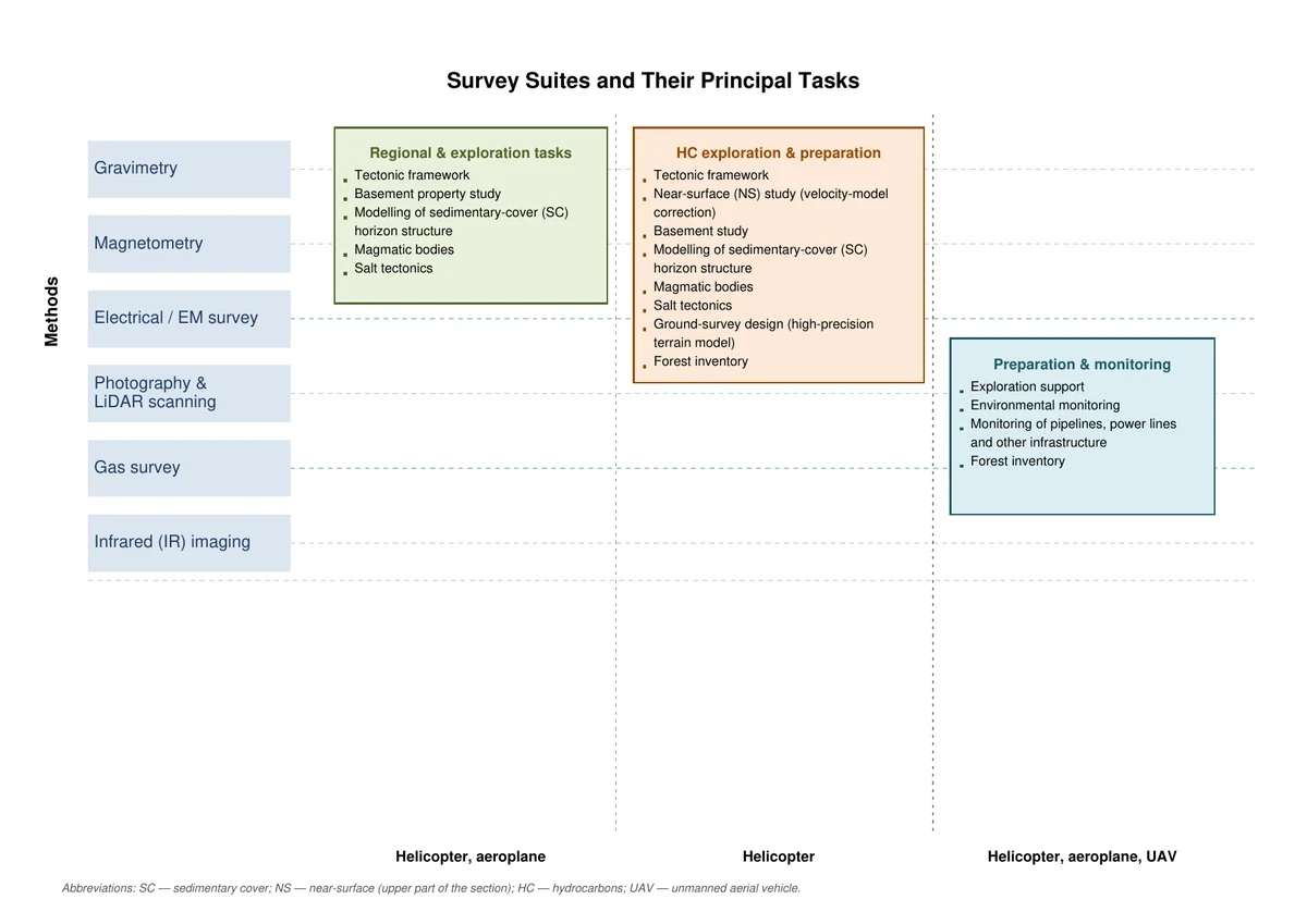
Given the expanded range of available airborne platforms and ongoing advances in sensor technology, the full spectrum of airborne geophysical services for hydrocarbon exploration can be organized into three principal service blocks.
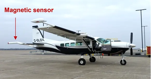
Tier 1 — Regional & Play-Scale Assessment Gravity and magnetics surveys addressing regional mapping and play-level exploration objectives. This tier is most applicable when an operator has secured access to a license block, is defining its exploration strategy, and is initiating hydrocarbon prospect generation. Platform: Cessna 208 Grand Caravan (or equivalent variant).
Tier 2 — Prospect Generation & Ground Program Preparation In addition to gravity and magnetics data includes airborne electromagnetics, aerial photography, and LiDAR. Addresses regional and prospect-scale geological objectives and supports the planning of ground-based exploration programs. Platform: helicopter.
Tier 3 — Exploration Monitoring & Operational Support A targeted method combination supporting ongoing exploration program management and monitoring for oil and gas operations. Platforms: ultralight aircraft and UAVs.
Data Processing & Interpretation — X-Vision Technology
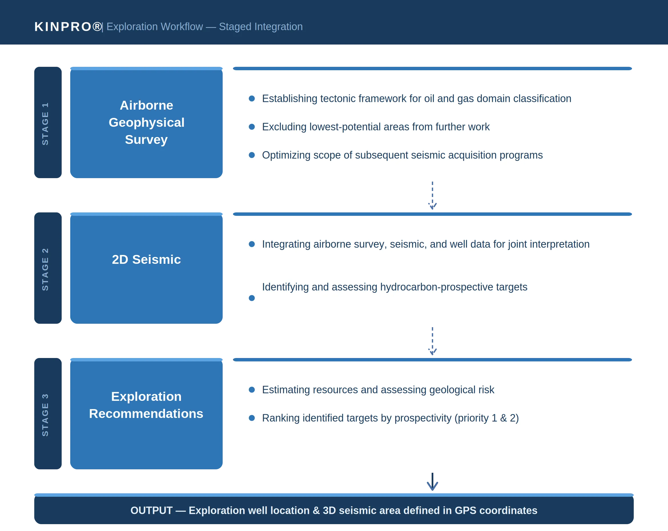
To date, algorithms for the processing and interpretation of airborne geophysical surveys and satellite remote sensing data have been substantially advanced through KINPRO's proprietary X-Vision technology platform.
New exploration-problem-solving algorithms are developed drawing on KINPRO's own accumulated survey experience, as well as the operational knowledge base of leading international oil and gas operators and airborne geophysical service companies.
Interpretation priority is placed on the integrated joint analysis of potential field data with ground-based electromagnetic, seismic, and well data. Processing and interpretation applies a bespoke — not standardized — regional approach for each survey area, producing an individually optimized solution that accounts for the specific geological character of each project. This methodology has demonstrated consistently high effectiveness.
Integrated interpretation results are used in the oil and gas industry to construct and refine geological models, which in turn serve as the basis for volumetric hydrocarbon assessment and the definition of follow-on exploration strategy.
Standard Deliverables — AGRS Programs
Following completion of all office-based data processing using X-Vision technology, the client receives the following deliverable package (baseline variant):
- As-flown flight-line map;
- Digital data archive containing raw and final leveled/tied survey data;
- Physical field grids and their derivatives;
- Full contour map sets for all acquired fields and their derivatives;
- Technical report documenting survey and processing methodology, instrument calibration procedures, and data quality verification.
Solid Mineral & Critical Mineral Exploration
Helicopter Magnetics & EM
Platform: Eurocopter AS350
Operational Rationale
The defining characteristics of airborne geophysical surveys — high throughput, multi-method integration capability, low unit cost, and high data information density — make them the logical leading-edge tool in exploration programs, enabling interpretation of their results to drive real-time management of the prospect generation phase ahead of ground-based follow-up.
Standard Method Combination for Solid Mineral Targets
A key advantage of airborne geophysical technology is the effectiveness of multi-method integration. The standard KINPRO® method suite for solid mineral and critical mineral exploration includes:
- Airborne magnetics (always included)
- Pulsed time-domain EM (TDEM) or frequency-domain EM (FDEM) (included in the majority of programs)
- Airborne gamma-ray spectrometry (included in the majority of programs)
- Aerogravity (project-specific)
- LiDAR and aerial photography (where required)
Program Execution Sequence
- Pre-mobilization planning and preparation, including acquisition of all required regulatory permits;
- Survey flight execution, including system setup, tuning, and calibration flights;
- Raw data acquisition and office-based processing;
- Geological-geophysical interpretation of airborne data, with delineation of priority target areas for ground-based follow-up verification.
Standard Deliverables — Helicopter EM & Magnetics Programs
Following completion of all office-based data processing using X-Vision technology, the client receives the following deliverable package (baseline variant):
- As-flown flight-line map;
- Digital data archive containing raw and final leveled/tied survey data;
- Physical field grids and derivative transform grids;
- Full contour map sets for all acquired fields and derivatives;
- Technical report documenting survey and processing methodology and data quality verification.
X-Vision Integrated Interpretation
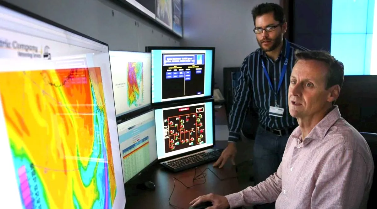
Integrated interpretation using X-Vision technology is executed in two sequential phases.
Phase 1 — General Geological Interpretation
The first phase addresses broad geological objectives: structural-tectonic and lithological-petrophysical mapping, landscape-geological domain classification, and related baseline tasks. This phase establishes the geological framework that defines exploration targeting in the subsequent phase.
Phase 2 — Exploration-Targeted Interpretation
The exploration-oriented phase is executed using the full body of available prior geological and geophysical data. The specific methods applied vary substantially depending on the nature of the target.
- For well-defined targets with clear physical contrasts and boundaries, local quantitative interpretation methods are most effective — focused on resolving the geometry and petrophysical parameters of discrete geological bodies.
- For low-contrast targets — such as primary precious metal and critical mineral deposits — the most effective approach combines two complementary workflows: sequential predictive mapping of mineralization localization factors, and probabilistic forecasting using pattern-recognition algorithms. In both cases, specialized data analysis and forward modeling methods play the decisive interpretive role.
Interpretation Deliverables
The X-Vision integrated interpretation program produces the following outputs:
- A geological-geophysical interpretation map incorporating predictive elements, delineating the most clearly expressed structural and lithological features, mineralization localization criteria and indicators, and prioritized prospective targets classified as first-priority and second-priority;
- A technical report documenting the interpretation methodology, program results, and prioritized recommendations for the direction and sequencing of follow-on exploration on identified prospective target areas.